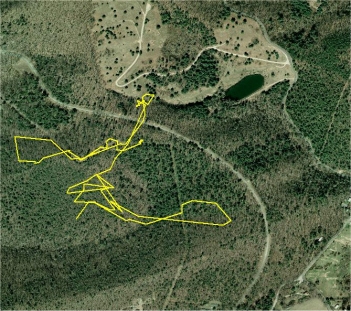
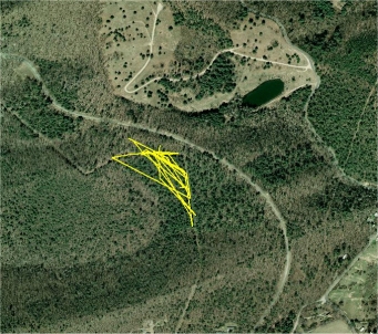
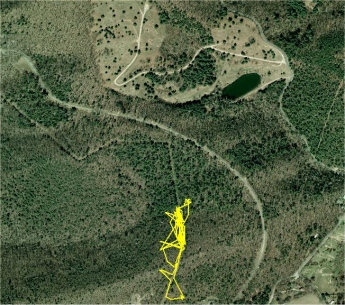
Turtle M13 (M). M13 is known for long travels, and this season's travel has been exceptional. He once came back to within 50 feet of the roadway so I assumed he was preparing to cross back into his more often used area, but within a day he turned around and traveled quickly toward and through the meadow. He travels fast and he can travel back to his normal activity area in a day or two when he wishes. 2.4 GPS miles tracked this season.
He did not use the pond as the photo might suggest, but stayed on the high bank for a time. M13 did not return to what I thought was his normal activity area, for the winter.
Turtle M20 (M). This map shows both his 2012 travels (red line) and his 2013 travels (yellow line), 2.5 GPS miles total. M20 was lost the spring of 2014 when his transmitter fell off at emergence, and was never re-found.
M20 was found in 2012 at an elevation of 2800 ft, traveled to 3480 ft over the course of the summer, hibernated there, and in 2013 traveled over the ridge-top, and down the other side to an elevation of 2800 ft near a busy state highway.
Is M20 a transient? He spent a lot of last season mixing with the rest of the population, meeting and mating with a number of turtles and traveling as if he knew the area.
M20 is missing a front limb!
The watchword for the 2013 summer season was dispersal. Many turtles from this study area traveled further from their primary activity areas and stayed away longer, than the several previous years of tracking and observation.
After 239 GPS miles hiked and over 1500 turtle locations recorded, the 2013 summer season has ended and all tracked turtles are underground for the winter. The winter started with a number of short but very cold (10 degrees F) periods, with the first snow occurring on 11/28/13.
All turtle travel route photos have been posted in their proper pages alongside the previous years travels.
Terrapene carolina carolina
A Relict Population Doomed To Extinction?


